> ## Documentation Index
> Fetch the complete documentation index at: https://stem-docs.intellectualpoint.com/llms.txt
> Use this file to discover all available pages before exploring further.
# Drones in the real world
> Explore the many ways drones are changing industries, saving lives, and creating new jobs.
## Drones do real work
The little drone you're flying shares its DNA with machines doing serious jobs around the world. Drones go where people can't - or shouldn't - and do it faster and cheaper. Here's where they're making a difference.
 ## Industries transformed by drones
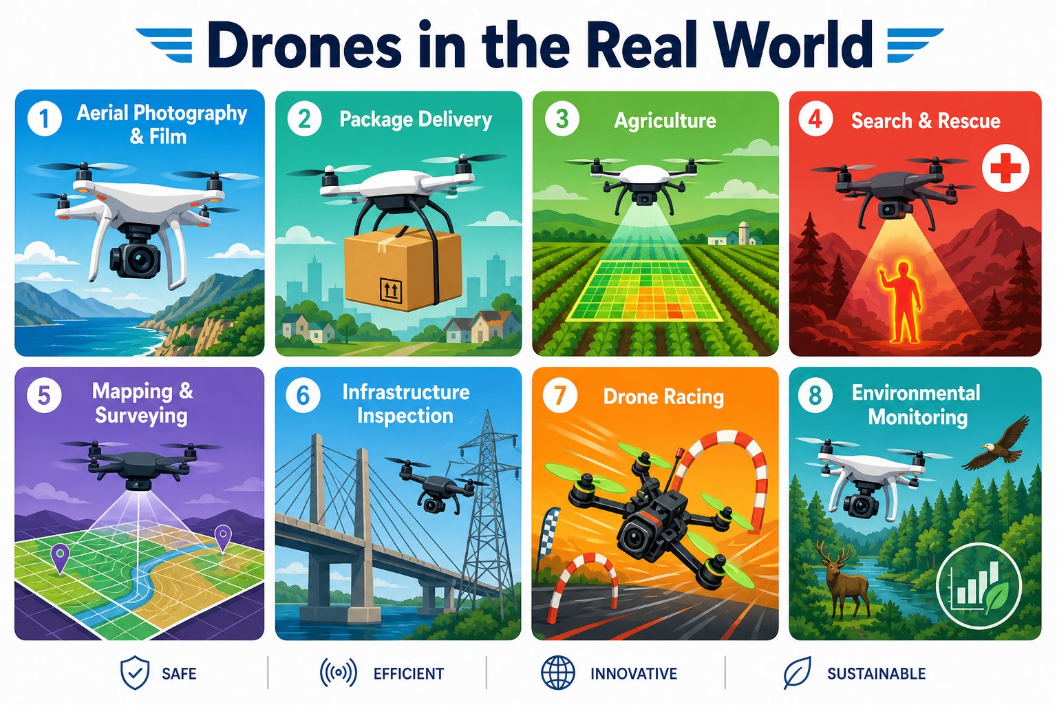
Sweeping aerial shots that once needed a helicopter and a crew now come from a single drone. Movies, live sports, real estate, and weddings all rely on drone cinematography.
Companies deliver medicine, blood, food, and packages by drone - reaching remote villages in minutes and cutting delivery times in cities.
Farmers fly drones to scan fields, spot sick or thirsty crops from the air, map soil, and spray precisely where it's needed - growing more food with less waste.
Drones with thermal cameras find lost hikers and disaster survivors by their body heat, day or night, and reach places rescuers can't get to quickly.
Drones photograph land from above and stitch the images into precise 3D maps for construction, mining, and city planning.
Instead of sending people up ladders and towers, drones inspect bridges, power lines, wind turbines, and rooftops safely and fast.
Researchers track wildlife, monitor forests and glaciers, count animals, and study storms - all without disturbing the environment.
FPV racing is a fast-growing sport where pilots fly custom drones through courses at over 100 mph, watching through video goggles.
## Why drones are so useful
## Industries transformed by drones
Sweeping aerial shots that once needed a helicopter and a crew now come from a single drone. Movies, live sports, real estate, and weddings all rely on drone cinematography.
Companies deliver medicine, blood, food, and packages by drone - reaching remote villages in minutes and cutting delivery times in cities.
Farmers fly drones to scan fields, spot sick or thirsty crops from the air, map soil, and spray precisely where it's needed - growing more food with less waste.
Drones with thermal cameras find lost hikers and disaster survivors by their body heat, day or night, and reach places rescuers can't get to quickly.
Drones photograph land from above and stitch the images into precise 3D maps for construction, mining, and city planning.
Instead of sending people up ladders and towers, drones inspect bridges, power lines, wind turbines, and rooftops safely and fast.
Researchers track wildlife, monitor forests and glaciers, count animals, and study storms - all without disturbing the environment.
FPV racing is a fast-growing sport where pilots fly custom drones through courses at over 100 mph, watching through video goggles.
## Why drones are so useful
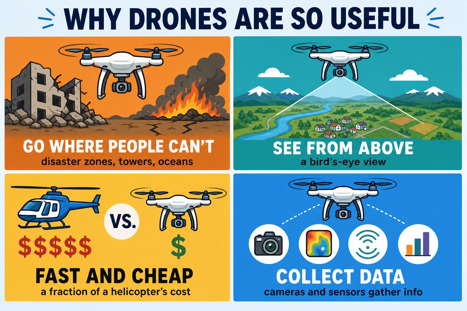 Into disaster zones, up towers, over oceans - safely and without risking a person.
A bird's-eye view reveals things you'd never notice from the ground.
A drone flight costs a tiny fraction of a helicopter or a crew of workers.
Cameras and sensors turn every flight into maps, measurements, and insights.
## The technology behind the jobs
Notice how the same building blocks show up everywhere: a **camera**, **sensors**, **stable flight**, and increasingly **code** that lets the drone fly missions on its own. That last part - programming - is exactly what you learned this week, and it's what turns a flying camera into a tool that can inspect a whole bridge or map an entire farm by itself.
Into disaster zones, up towers, over oceans - safely and without risking a person.
A bird's-eye view reveals things you'd never notice from the ground.
A drone flight costs a tiny fraction of a helicopter or a crew of workers.
Cameras and sensors turn every flight into maps, measurements, and insights.
## The technology behind the jobs
Notice how the same building blocks show up everywhere: a **camera**, **sensors**, **stable flight**, and increasingly **code** that lets the drone fly missions on its own. That last part - programming - is exactly what you learned this week, and it's what turns a flying camera into a tool that can inspect a whole bridge or map an entire farm by itself.
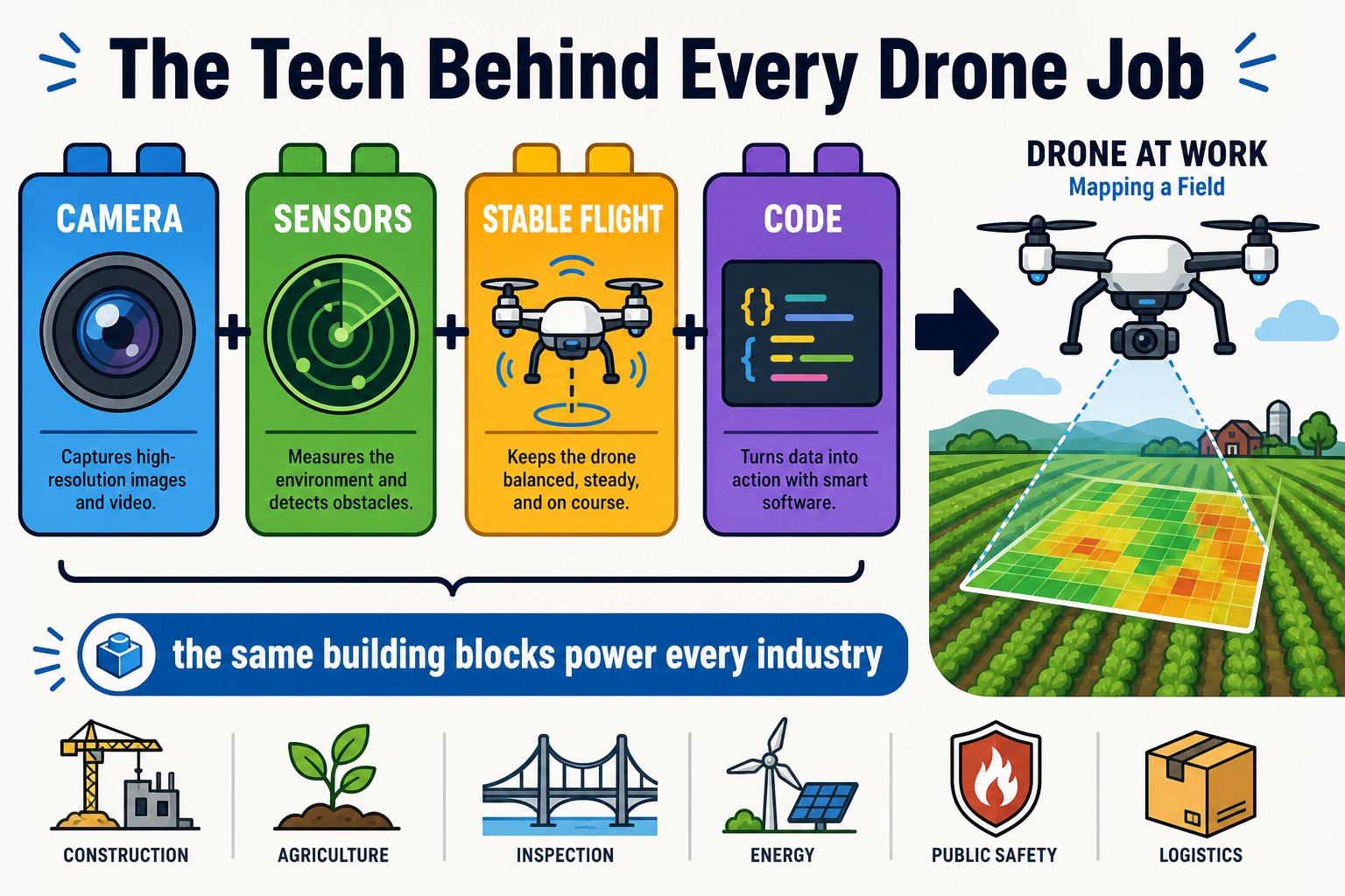 **Make it personal:** The Echo Drone in your hands has the *exact same four layers* as a \$30,000 mapping drone - flight, sensors, camera, and code. The difference is scale, not concept. Everything you learned this week is the real foundation.
Pick an industry that interests you and imagine a new job a drone could do there. The best capstone ideas often come from spotting a real problem a flying, programmable camera could solve.
You can name at least five industries that use drones and explain why drones are so valuable for those jobs.
**Make it personal:** The Echo Drone in your hands has the *exact same four layers* as a \$30,000 mapping drone - flight, sensors, camera, and code. The difference is scale, not concept. Everything you learned this week is the real foundation.
Pick an industry that interests you and imagine a new job a drone could do there. The best capstone ideas often come from spotting a real problem a flying, programmable camera could solve.
You can name at least five industries that use drones and explain why drones are so valuable for those jobs.